Even Most Eastern Sierra Locals Don’t Know About This Hike With A Spectacular View

By Kimberly Wilkes • Photographs by Patrick Wilkes
Last year, Patrick and I discovered a hike that boasts one of the most spectacular views in the Eastern Sierra. It’s located near Monitor Pass by Walker, California and Markleeville.
I’ve hiked up to Kearsarge Pass and Bishop Pass and the view at the end of this hike rivals that from those more well-known excursions. It’s a different type of view, though. Instead of looking out toward the Sierra Crest to the west, it faces the mountains to the east and south, with a glimpse of the Eastern Front of the Sierra.
Added bonuses include wildflowers and Basque sheepherder carvings on the aspens lining the trail. In the fall, these trees are ablaze with color.
The sound of the aspens quivering in the breeze accompanied Patrick and me as we hiked along the trail again this year with our mascots Booblash the Wonder Mole and Blue-Footed Booby.

Booblash the Wonder Mole
Our Virtually Undiscovered Spot
The trail—really a dirt road—begins .7 miles to the east of Monitor Pass on Forest Service Road 358 on the south side of Highway 89. If you’re arriving from the east on Highway 89 from Markleeville, you’ll have to drive past a long stretch of charred forest, the damage done by a fire early in the summer of 2015. As much as it broke my heart to see that much of the forest destroyed, it was interesting looking at some trees that were half green and half black. An almost perfectly straight line divided the two colors. We were curious why the fire burnt precisely half the tree, and left the other half undamaged.
The aspens atop Monitor Pass seemed so much greener in contrast to the charcoal-black and brown trees we had just driven past.
Earl Grey, our Toyota Matrix, is a 4WD, but he’s not a lean, mean, high-clearance machine, so we parked near a grove of aspens about 1/8 mile in on Road 358. If you have a high-clearance vehicle you can get farther up the road. If not, or if you want extra exercise, park where we did.
In the fall, when the aspens put on their gold, red, and orange outfits, you’ll likely encounter other people admiring the foliage here. But few of them will ever hike or drive their 4WD all the way up the road to the spectacular view.

Looking back down toward Highway 89
Two Roads Diverged In the Woods
You have two choices after parking the car. One branch of the dirt road curves around to the left and then bears right again up a hill, while the other bears immediately right. Each of these two branches of the road leads to a spectacular view.
The road that curves around to the left has more Basque sheepherder carvings on the aspens lining the road. They’re still around on the right spur of the road but are harder to spot. The left branch also is a slightly easier walk.
But we’re drawn to the road that bears immediately right because it’s higher up and has a slightly better view at road’s end. Plus, most vehicles struggle to make it up this branch of the road, meaning there is less chance of encountering anyone there.
By the way, the spur road in the middle of these other two branches dead ends a little ways up. So avoid that route.
We began hiking up the right branch of the road, passing a couple dispersed camping spaces, longing to be spending the night there, and arriving at what I think of as the dirt moguls. Here, the road undulates up and down over tall bumps for about 24 feet. Bring hiking poles or find a sturdy walking stick in the woods, because this section of road is treacherous, especially on the return trip. I fell on my fanny the last time we hiked here.
A Late-Season Surprise

Late-blooming asters
Not far past the moguls, the aspens back away from the road, and the sagebrush and rabbitbrush take over. It was here, on August 16, that we spotted the first of the late-season wildflowers: red paintbrush, at least two varieties of lupines including the short and stubby Lobb’s lupine, and flowers that formed dime-sized fuchsia cups. The rabbitbrush also had started to burst into bloom.
The flowers kept us company as we rounded a bend in the road, which sliced through a meadow of sagebrush squeezed between two groves of aspens about a quarter of a mile into the hike. At the far end of the meadow, the road passes through another grove of aspens and starts to climb.

More late-season wildflowers

The View Is Revealed
About a half mile from the parked car, the road spills out from the aspen grove into another meadow covered in sagebrush. Suddenly, you’re confronted with one of the most panoramic views in the Eastern Sierra.

The view east-northeast from our secret lookout.
The road ends here, so if you want to get close to the view, you need to wander through grass, sagebrush, and other high desert vegetation. Just watch your step and be careful of the drop-off.
Perched on a natural lookout, you have a front row seat looking at the scenic show provided by the mountains to the east of Antelope Valley. The summits of three of those mountains are so white it almost looks like they’re covered in snow. Below the mountains, the green Antelope Valley croplands sit in sharp contrast to the muted colors of the mountains.
To the south, the view is equally spectacular. Walker, California is just out of sight behind the mountains to the east of Slinkard Valley. But the majestic peaks soaring up to the south and west of Walker are in full view. Far below, highway 89 wiggles its way down toward Antelope Valley and Highway 395.

Here’s what the view looked like on Memorial Day. Photo by Kim Wilkes
The hike to the top of Leviathan Peak probably has a more far-reaching view than our “secret” lookout, because you can see Topaz Lake from there and the Sierra Crest. But it’s a harder hike, more exposed, and the trail up isn’t lined with aspens. You’re also farther away from the view there. In our secret lookout, it feels like the view rushes up to greet you. Leviathan Peak is still a beautiful hike—but when we want a relatively easy hike to a spectacular view, we choose this lesser known spot.
There are places in the world that radiate peace. You can feel it in the same way you can feel the rays of the sun warming your skin. This serene spot near Monitor Pass is one of those places.
Perhaps we’ll run into you there sometime.
If You’re Going
The smoke from the Walker Fire, the Rough Fire, and possibly other infernos around the state are drifting towards Monitor Pass. When I took a walk last night (August 21, 2015) in Gardnerville, I could see a lot of smoke near Monitor Pass. You may want to check the air quality and/or the status of nearby fires before venturing over there. The website Inciweb reports on the status of all fires.
Finding the Trailhead:
From Markleeville, California, follow Highway 89/4 to where the two highways separate. Turn left on Highway 89 and follow it to Monitor Pass. Drive approximately .7 miles past Monitor Pass to Forest Service Road 358 on the south side of the highway.
You won’t be able to see the sign for Road 358 from Highway 89. Instead, watch for where the aspens are pushed back a ways from Highway 89 on the right. On the left, you’ll see Leviathan Peak with the lookout on top. If the Highway starts descending down toward Highway 395 you’ve gone too far.
From Walker, California, drive 9.8 miles north on Highway 395. Turn left on Highway 89 and follow it up to the top where you see a dirt road on your left about .7 miles to the east of Monitor Pass. The dirt road starts out in the grass and sagebrush but leads into the aspens far back from the highway. Turn left on the dirt road. Leviathan Peak (the big barren mountain with the lookout on top) will be on your right.
Elevation at Trailhead: Approximately 8,300 feet.
Elevation Gain: Approximately 150 feet.
Hike Distance: Roughly ½ mile from the first grove of aspens.
Hike Difficulty: Moderate if you choose to take the road with the dirt moguls.
Nearest Campgrounds: Markleeville Campground, Silver Creek Campground, Turtle Rock State Park, Bootleg Campground, and Chris Flat.
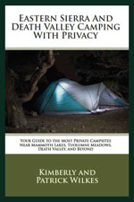
Ever know anyone crazy enough to look at 3,416 campsites in one season? That’s what Patrick and I did in order to find out which campsites had the most privacy. Then we critiqued and rated each privacy-worthy site in our newly released book, Eastern Sierra And Death Valley Camping With Privacy: Your Guide To The Most Private Campsites Near Mammoth Lakes, Tuolumne Meadows, Death Valley, And Beyond. The book shows you exactly which campsites are the most private so you know which ones to reserve or which first-come, first-served campgrounds have the best spaces.